Seismic
Seismic Permitting
- Surface & mineral permit acquisitions
- Working interest permitting & agreements
- Regulatory agency permitting
- Land damage mitigation & settlement
Our mission
To administer and achieve your land department's objectives in a responsible, cost-effective and efficient manner, from ownership research and agreement negotiations to custom mapping and reports.
Services
Conventional and resource plays, carbon capture and storage, pipeline and utility projects, acquisitions and divestitures.
Seismic
Leasing
Title
Curative
ROW
CCS
A&D

Affiliate
Environmental services are provided through our affiliate, SEG Environmental.
Visit segenviro.com →GIS solutions
Our GIS team prepares and distributes detailed land plats for any project and builds custom maps to your specifications. Project Smart Maps run on our secure GIS server, so your team has real-time information on the web or a phone, 24 hours a day.

Clickable project maps tied to your land data.
Maps that update as ownership and lease records change.
Leases, wells, tracts and easements in one spatial record.
Online and mobile access through our secure GIS server.
Detailed plats prepared and distributed for any project.
Maps and reports tailored to your specific requests.
Project dashboards & reporting
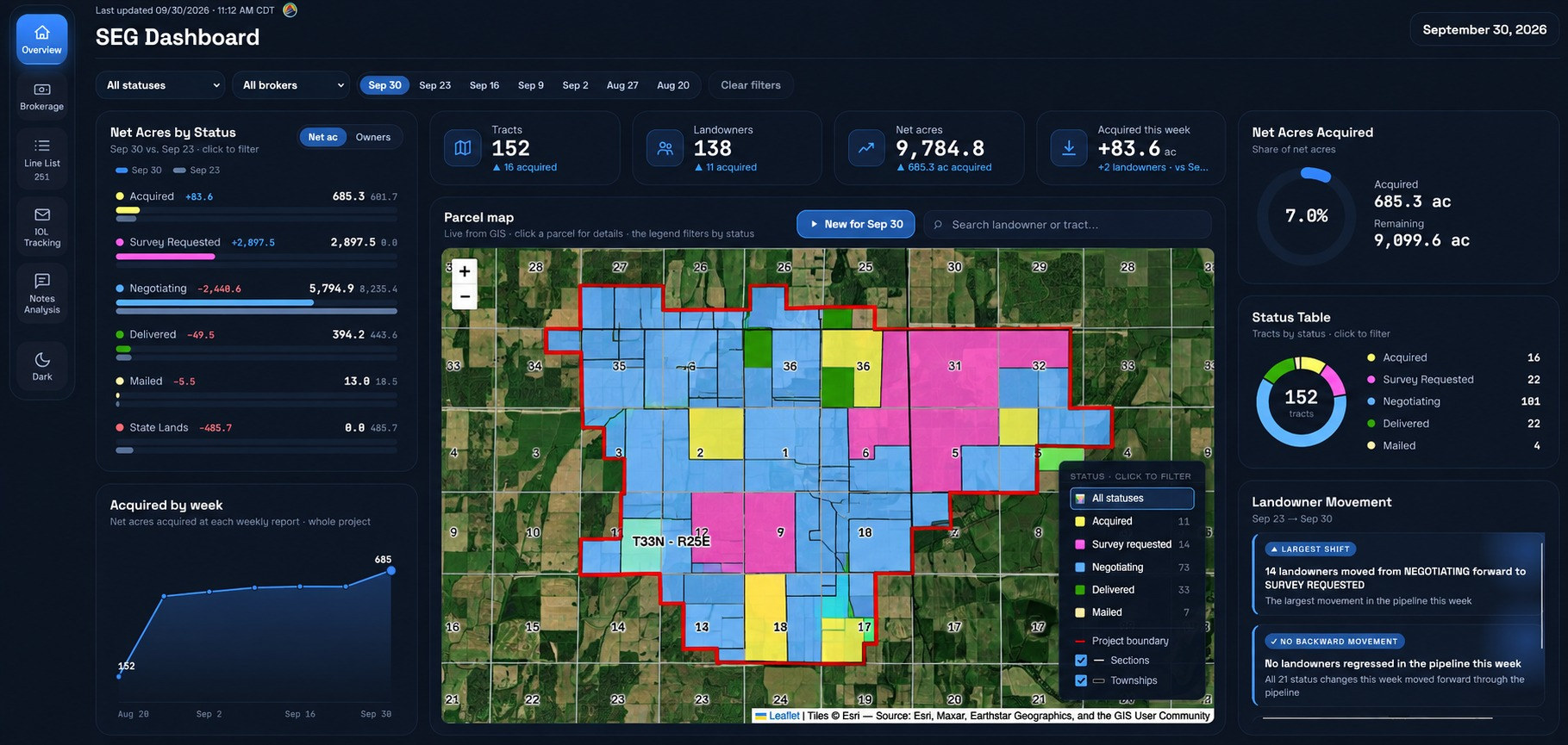
Project dashboards built on your GIS data track leasing, title, curative and right-of-way progress tract by tract, so your team always knows what is done, what is pending and what needs attention.
Leadership
President, Senior Project Manager
Vice President, Real Estate, Accounting
Senior Project Manager
GIS Coordinator
Presence
From our headquarters in Lafayette, Louisiana, SEGI supports land departments across the lower 48 states. Select a state on the map for details.
Careers
Send your resume to resume@segland.com.
Contact